Overview
The Streetview Tile shows street-level imagery for an address on the Entity Explorer page. Rules decide when it appears, using the standard Hubstream rules — the same conditions the other tiles use.
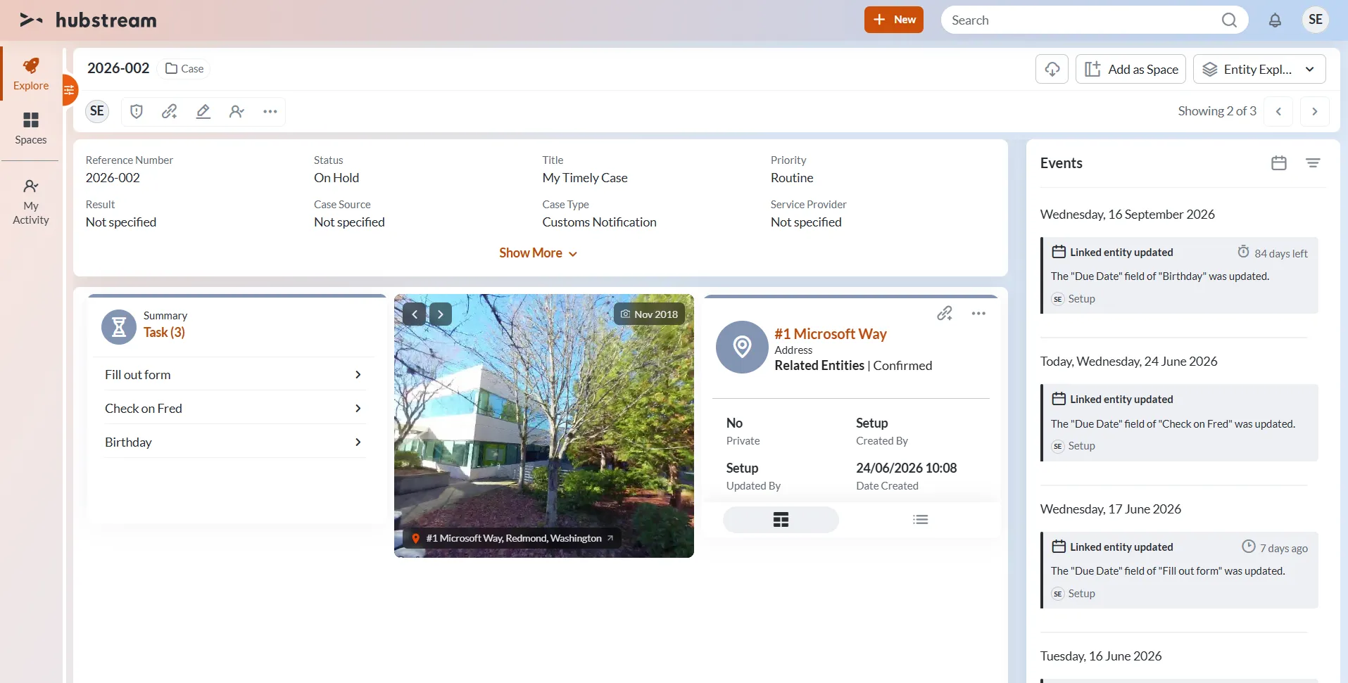
The tile on a case, drawing the street view for the case’s related address. The badge top right dates the imagery, and the caption bottom left names the address.
The address doesn’t have to be the entity you’re on. In the example above you’re looking at a case, and the tile resolves the address from the Address entity linked to it.
What’s on the tile
- The street-level photo for the address.
- The capture date, top right. Street view imagery is whatever the provider has, and it can be years old — the example is from November 2018.
- The address, bottom left.
- Arrows, top left, to move through the available imagery.
Configuration
The tile’s Properties JSON is configured in the admin, using the standard rule conditions. See the Marquee Tile or StickerBook Tile for how conditions are written, including scope and how a field value is matched.
The exact keys this tile takes aren’t documented yet.
Common gotchas
- The imagery isn’t current. Check the capture date before you rely on what you see. A building may have changed since the photo was taken.
- Coverage depends on the provider. Not every address has street-level imagery.